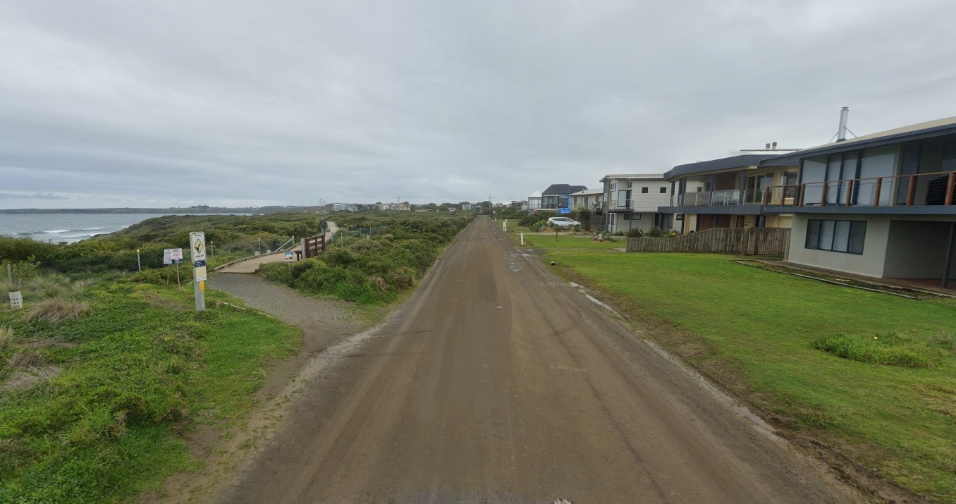
Council's Urban Roads and Drainage Improvement Program has helped improve infrastructure in Bass Coast for many years.
These upgrades are usually delivered through Special Charge Schemes. This is a way for Council to raise money for an upgrade project by charging property owners that benefit from the upgrade. This is allowed by the Local Government Act 1989.
This process means many communities now have better infrastructure like sealed roads, kerbs, footpaths, drainage, and other important amenities. The Council also helps pay for these projects if they benefit the wider community, not just the upgraded area.
The project to upgrade The Esplanade (Sunderland Bay Road to Batman Street) was started in response to a petition to Council that was received in February 2024.
The project was supported by property owners through the legislative process and formally declared in September 2025. Updates on the project will be provided below.
Project Update July 2026
Council has been working with consultants to complete detailed design plans. These plans will guide construction and are crucial to ensure the final project is safe and functional. You can access these plans here.
A number of property owners have contacted Council to express their concerns in regard to the distance between their existing front boundary and the upgraded road edge.
A cross section of the adopted road design, including distance from road edge and property boundaries, is shown below.
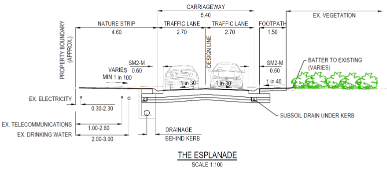
The detailed design was completed in accordance with the adopted concept plans with the distance between property fences and the edge of the road being 4.6m. The initial decision to shift the road edge north was made on best principles of avoiding and minimising vegetation removal in line with Council’s obligations under the Victorian Planning Provisions and Bass Coast Planning Scheme.
The new distance of 4.6m from the road edge to property boundaries is closer than the existing distance, which ranges from 6.1m to 7.4m in distance.
The concept plan presented to property owners throughout the legislative process illustrated this change however could not be marked with a distance until the exact dimensions were confirmed in detailed designs. For this reason, we acknowledge that some property owners may not have been fully aware of this change.
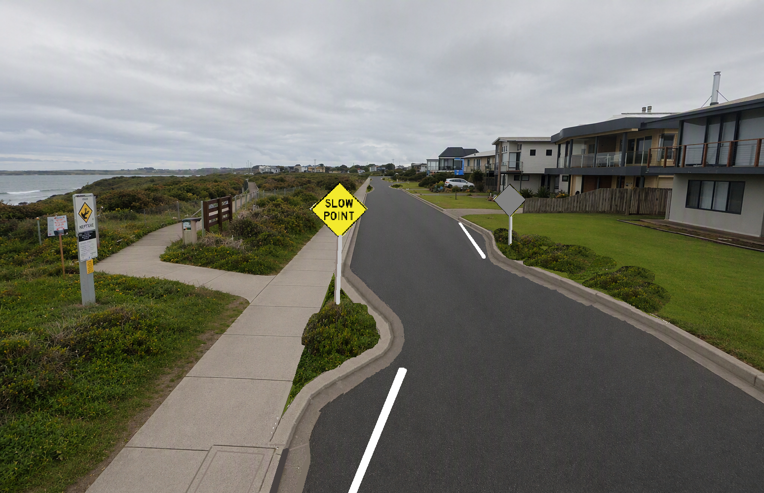
The distance of 4.6m is considered reasonable and safe for urban areas. The inclusion of zig zag chicanes to slow traffic and the upcoming reduction of the speed limit to 30km/hr will also improve road safety and reduce traffic noise.
Council is currently seeking feedback from the Victorian Department of Energy, Environment and Climate (DEECA), Phillip Island Nature Parks and other stakeholders regarding all possible options to address property owner concerns prior to proceeding with the project.
Property owners will be informed of the outcome of DEECA’s advice as soon as possible. The outcome of this advice will help guide Council’s next steps.
Further information on the removal of native vegetation can be found on the following website: www.environment.vic.gov.au/native-vegetation/native-vegetation/native-vegetation-removal-regulations
Project Update May 2026
Council is continuing to progress the road and drainage upgrade for The Esplanade (between Sunderland Bay Road and Batman Street).
A timeline is provided below to keep property owners and stakeholders informed of the current progress.
At this stage, construction works are anticipated to commence in mid‑late 2027.
Next steps
June 2026
Detailed design completed
Detailed design is currently being finalised by Beveridge Williams.
September 2026
Invoices sent to property owners
As per the Local Government Act 1989, invoices must be issued to property owners within 12 months of the declaration of a Special Charge.
November 2026
Cultural Heritage Management Plan complete
A Cultural Heritage Management Plan (CHMP) is a document that outlines how Aboriginal cultural heritage is protected and managed during construction and associated works. A CHMP is required when works are proposed in an area of cultural heritage sensitivity.
The CHMP process has already been commenced and is being completed in consultation with the Bunurong Land Council Aboriginal Corporation and a Heritage Advisor.
Late 2026/early 2027
Permits application
Once the Cultural Heritage Management Plan has been received, Council will apply for the necessary permits to undertake vegetation removal, complete Coastal Acid Sulphate testing and receive MACA (marine and coastal area) consent.
Early-mid 2027
Contract Tendering and Award
Mid-late 2027
Onground construction
Project Update February 2026
Council officers have been working with Beveridge Williams to undertake detailed design. This involves refining the details outlined in the Concept Plan to ensure all elements meet the aims of the project and are functional when construction occurs.
The functional layout plans for the project can be viewed here. A cross section of the road design is shown below.
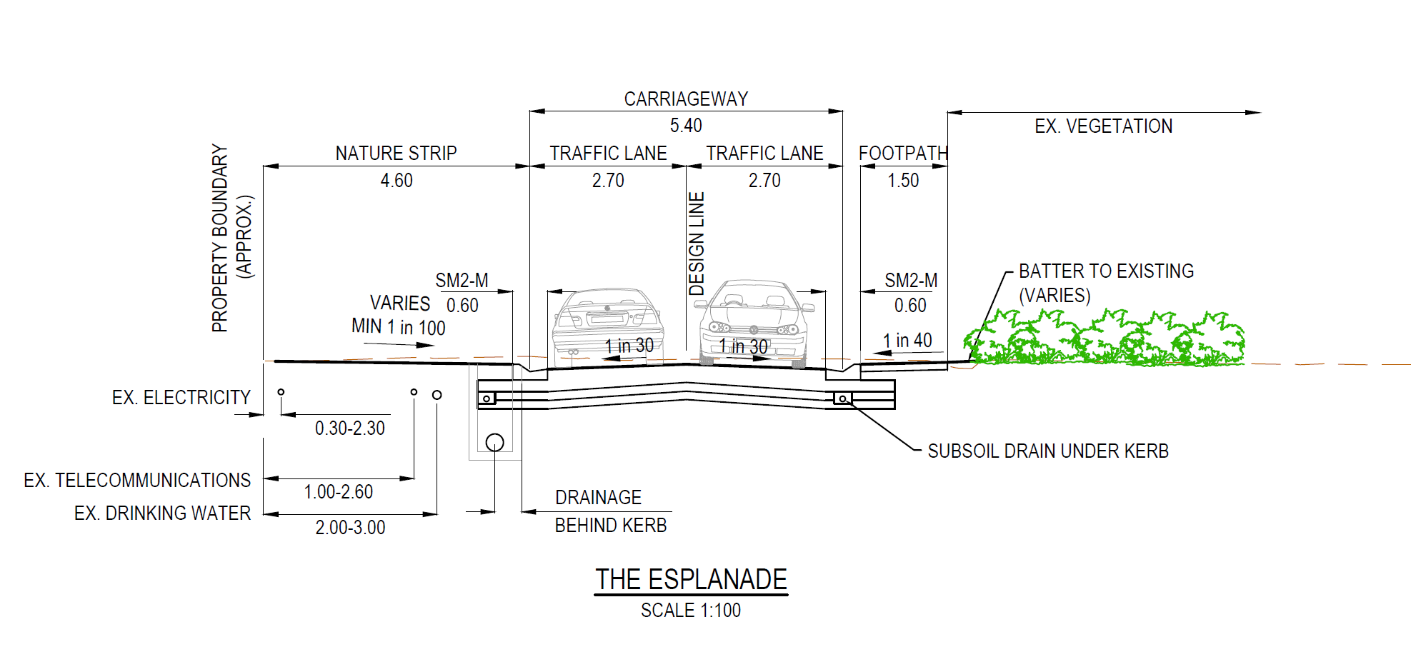
On ground service proving (locating underground utilities) has also commenced.
There is a variety of investigations that must be completed prior to construction including:
- Targeted species flora and fauna surveys
- Cultural Heritage Management Plan
- Coastal acid sulphate soil testing
These processes have been initiated by Council.
Next steps
- Detailed design is schedule to be completed by June 2026.
- Council will seek requests for tender through Council's procurement Policy to ensure value for money for property owners and Council.
- Permits for vegetation removal will be completed after detailed design.
Outcome of legislative process
Property owners were asked to provide submissions and/or objections for the proposed Special Charge Scheme. Property owners had until the 16 July 2025 to submit their response.
What might it look like?